Birmingham City Council
Tree preservation zone
There is a problem
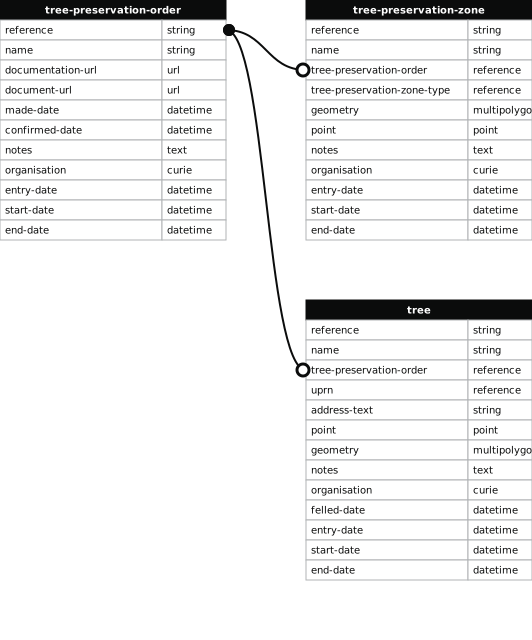
- 1000 entries with tree-preservation-order field must match the reference field in the tree preservation order dataset
THE BIRMINGHAM (330 GREEN MEADOW ROAD, WEOLEY) TPO 2009
- reference
- 1285
- name
- THE BIRMINGHAM (330 GREEN MEADOW ROAD, WEOLEY) TPO 2009
- tree-preservation-order
- TPO 1285
- tree-preservation-zone-type
- area
- geometry
- MULTIPOLYGON (((-1.973047 52.427403,-1.972722 52.427193,-1.972714 52.427191,-1.972684 52.427193,-1.972667 52.427199,-1.972581 52.427246,-1.972393 52.427340,-1.971983 52.427549,-1.972087 52.427573,-1.972314 52.427745,-1.972328 52.427751,-1.972342 52.427753,-1.972358 52.427749,-1.972374 52.427739,-1.972602 52.427614,-1.972544 52.427573,-1.972556 52.427567,-1.972551 52.427563,-1.972571 52.427552,-1.972606 52.427577,-1.972622 52.427568,-1.972667 52.427601,-1.972794 52.427530,-1.972862 52.427579,-1.973006 52.427507,-1.973018 52.427418,-1.973047 52.427403)))
- point
- POINT (-1.972547 52.427469)
- notes
- The shaded area represents those properties which fall within the outline of a Tree Preservation Order. To precisely identify trees protected by the Order, you can request a copy of the tree preservation order at the following link.
- entry-date
- 2026-10-15
- start-date
- end-date
How to fix this issue
Your data is missing a tree-preservation-order.
The tree preservation zone guidance explains how to fix the issue:
tree-preservation-order
The reference for the tree preservation order that covers this zone.
How to improve Birmingham City Council’s data
- Fix the errors indicated
- Use the check service to make sure the data meets the standard
- Publish the updated data on the endpoint URL